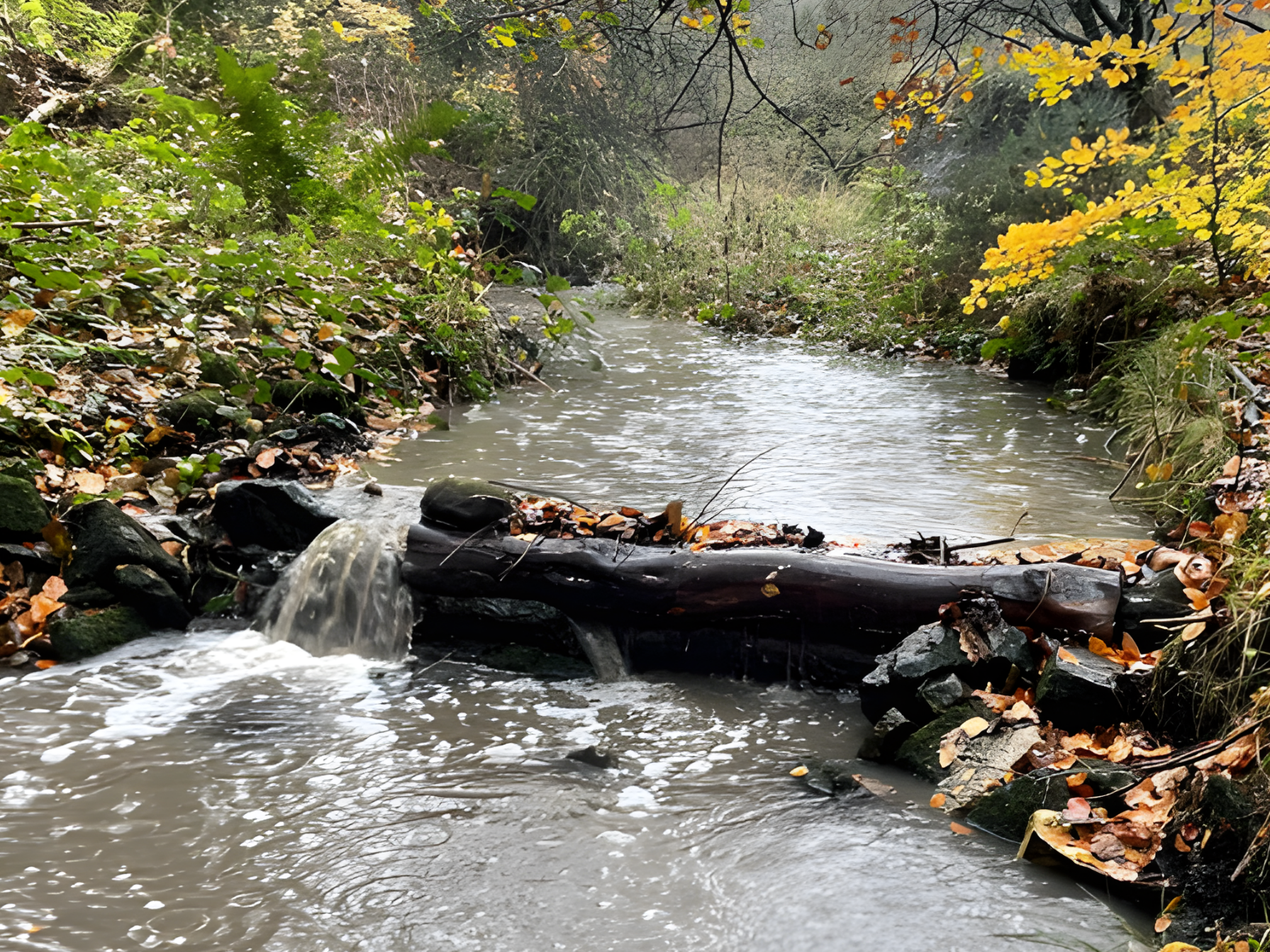
Wear Rivers Trust

Rivers & Water

Healthy rivers need clean water and space to function naturally. Our rivers and water work focuses on improving water quality, managing flood risk, and restoring river processes that benefit both communities and wildlife.

Our Approach

At Wear Rivers Trust we deliver practical, evidence-led projects across the Wear catchment to improve river condition and support sustainable water management. Our work addresses key pressures including declining water quality, modified river processes, and the risk of flooding, through a combination of monitoring, partnership working, and targeted on-the-ground delivery.

By restoring natural river function and implementing nature-based solutions, we support healthier, more resilient river systems that benefit wildlife, communities, and the wider catchment.

Flood Management

We manage flood risk by working with natural river processes to slow the flow of water, reduce peak flows, and support more resilient catchments over the long term.

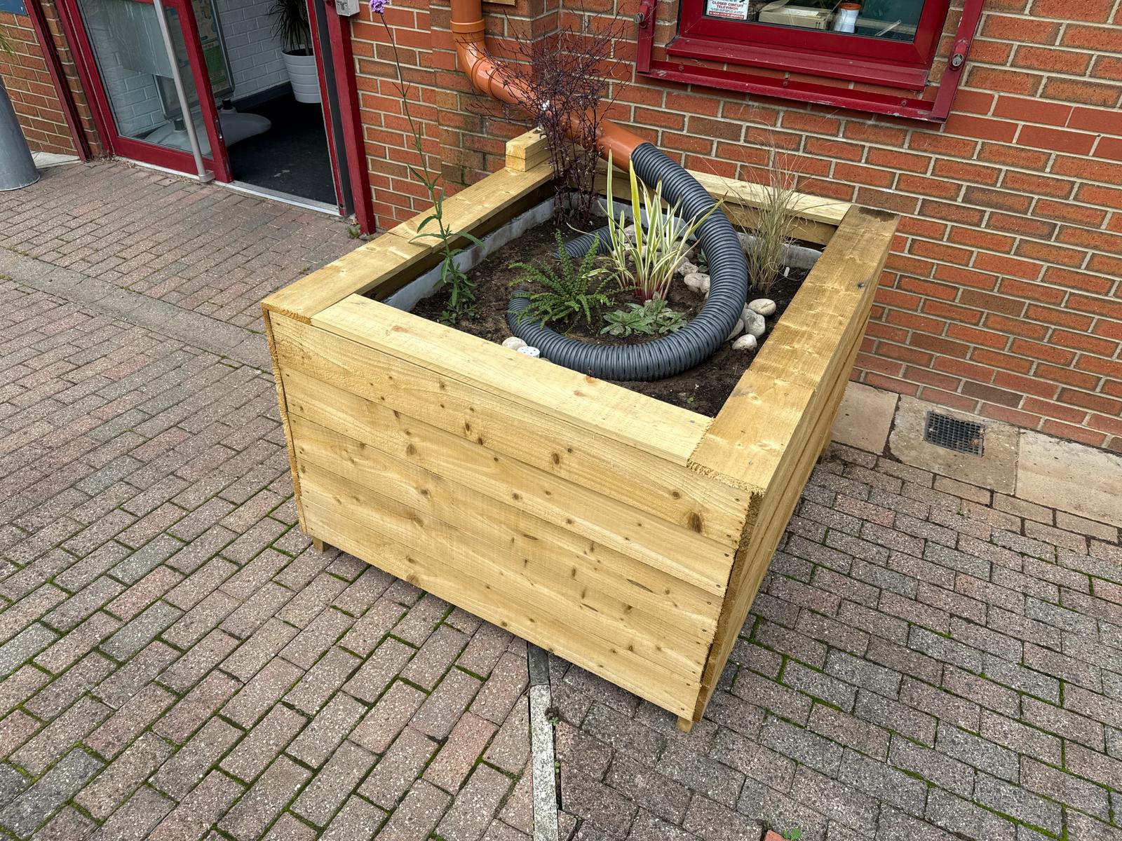
Sustainable Drainage Systems

We promote sustainable drainage systems that manage surface water more naturally, reducing runoff, improving water quality, and easing pressure on rivers and drainage networks.

Water Quality

We improve water quality by supporting healthier river systems and reducing pressures on rivers through catchment-based, nature-led solutions.

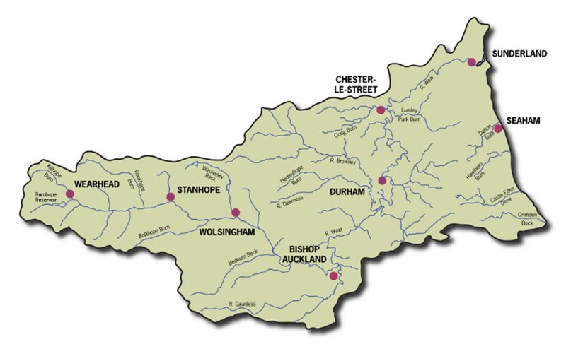
Catchment Based Approach

We take a catchment-based, partnership-led approach that recognises rivers as connected systems, delivering long-term solutions rather than short-term engineering fixes.

Working at Catchment Scale

The Wear catchment extends from the eastern North Pennines to the North Sea, covering much of County Durham and encompassing a diverse network of rivers, streams, and landscapes. The River Wear rises at Wearhead, where Killhope Burn and Burnhope Burn meet, and flows for approximately 97 km through upland moorland, rural valleys, and urban centres before reaching the coast at Sunderland. The catchment covers around 1,080 km² and includes numerous tributaries, notably the Rivers Browney and Gaunless. Land use varies from upland moorland and pastoral farming in the west to mixed agriculture and urban development in the east. The catchment’s rivers are shaped by a long industrial legacy, including historic mining, alongside more recent pressures such as sewage discharges, agricultural runoff, and urban drainage, all of which influence water quality and river health today.

Get Involved

Take part in practical conservation, volunteering and community action that supports healthier rivers and thriving wildlife.

Support Our Work

Help fund vital river and water conservation projects that protect freshwater habitats and deliver lasting benefits.